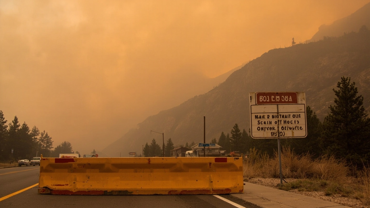
TL;DR: A fast-moving wildfire north of Ouray forced mandatory evacuations and a Highway 550 closure on June 27, 2026, as Red Flag conditions fueled multiple blazes across Colorado's Western Slope.
Gold Mountain Fire ignites north of Ouray
A wildfire ignited north of Ouray on June 27, 2026, in steep country below Gold Mountain Ranch and near the Bachelor Syracuse Mine Tour area off County Road 14, according to CBS Colorado.
The Ouray County Sheriff's Office identified the start location as below Gold Mountain Ranch and near the Bachelor Syracuse Mine Tour area off County Road 14, according to CBS Colorado.
The National Interagency Fire Center estimated the Gold Mountain Fire at approximately 1 acre in its earliest tally cited in that same CBS Colorado report.
The county emergency manager described the fire as 50 acres and spreading, as reported by the Ouray County Plaindealer and relayed by Colorado Public Radio.
The Ouray County Sheriff's Office said the fire started after a tree fell on a power line, according to Colorado Public Radio.
Ouray County's emergency information hub listed a public hotline at 970-626-5484 for Gold Mountain Fire information, according to the Ouray County News Flash Archive - Gold Mountain Fire Information page.
The information hub was published as an active notice running from June 27, 2026, according to the Ouray County News Flash Archive - Gold Mountain Fire Information page.
Mandatory evacuations ordered for Peck's Trailer Park and Red Stone Road
A mandatory evacuation order was issued for residents in the Peck's Trailer Park and Red Stone Road areas north of Ouray, according to CBS Colorado.
The Sheriff's Office said residents in those areas needed to leave immediately, according to CBS Colorado.
Hwy 550 between Ouray and Whispering Pines was closed because of the growing wildfire north of Ouray, according to CBS Colorado.
An evacuation center was established at Ridgway Secondary School at 1200 Green St in Ridgway, according to CBS Colorado.
Mandatory evacuations were underway north of Ouray because of the Gold Mountain fire, with more areas under pre-evacuation notices, according to Colorado Public Radio.
The Ouray County Plaindealer's account of the county emergency manager's 50-acre spreading estimate underscored why deputies moved quickly to clear homes closest to County Road 14, according to Colorado Public Radio.
Households directed to leave immediately were told to depart without delay rather than wait to gather nonessential belongings, under the mandatory-evacuation meaning used by Ouray County officials.
Where to go and how roads were restricted
Evacuees from the Peck's Trailer Park and Red Stone Road zones were directed to Ridgway Secondary School at 1200 Green St, Ridgway, according to CBS Colorado.
The closure of Hwy 550 between Ouray and Whispering Pines cut the direct route north from Ouray, according to CBS Colorado.
Residents and visitors were urged to respect roadblocks and avoid the fire area so engines, crews and aircraft could work, in line with the suppression guidance issued by the Upper Colorado River Interagency Fire Management Unit and cited by CBS Colorado.
The Upper Colorado River Interagency Fire Management Unit said multiple resources, including aircraft, were working to bring wildfires under control, according to CBS Colorado.
That interagency unit described the new starts as part of eight fires started by lightning strikes on Bureau of Land Management lands over the prior 24 hours, according to CBS Colorado.
Montezuma County officials said all air support had been grounded due to wind in the southwestern fire zone, according to CBS Colorado.
A regional outbreak stretched crews across the Western Slope
The Gold Mountain Fire was one of several fires burning across the Western Slope on June 27, according to Colorado Public Radio.
Colorado Public Radio reported that several fires burning on Colorado's Western Slope had burned tens of thousands of acres.
The Jones Fire and Snyder Mesa Fire were burning just south of the Colorado River and had spread into Colorado, according to the Moab Valley Fire Department as cited by CBS Colorado.
Officials announced Saturday evening that the Snyder Mesa Fire and the Jones Fire had merged and had burned approximately 28,264 acres, according to CBS Colorado.
The Jones Canyon fire was reported at 20 acres on Saturday morning but continued to grow before the merger, according to CBS Colorado.
A pre-evacuation notice was issued for parts of western Mesa County, including all properties on BS Road west of 11 5/10 Road to the Utah border, according to CBS Colorado.
That Mesa County pre-evacuation notice was later expanded to cover 11 5/10 Road to 16 1/2 Road, on BS Road west to Utah, according to CBS Colorado.
Deputies went door to door to notify residents in the Mesa County pre-evacuation zone, according to CBS Colorado.
Authorities closed A 2/10 Road at DS Road and BS Road to the Bureau of Land Management boundary, according to CBS Colorado.
The Mesa County Sheriff's Office said anyone needing help sheltering large animals should contact Mesa County Fairground Manager Kyle Carstens at (970) 773-1621, according to CBS Colorado.
Other Western Slope starts added smoke and strain
Another fire began near Redrock Canyon, 12 miles northeast of Grand Junction, on Saturday morning and grew to approximately 33 acres, according to the National Interagency Fire Center as cited by CBS Colorado.
The Red Rock Fire was also burning on Bureau of Land Management lands, according to CBS Colorado.
The Far Draw Fire northeast of Cahone northeast of Cahone had burned approximately 650 acres, according to CBS Colorado.
The Ferris Fire farther south had burned approximately 4,776 acres and prompted an evacuation order for Lone Dome Road and 521 Road up to McPhee Dam and for everyone at Bradfield Campground, according to CBS Colorado.
Late Saturday night, an evacuation order was issued for the Glade Ranch subdivision in the Ferris Fire area, according to CBS Colorado.
Evacuees from the Ferris Fire were welcomed at Pleasant View Fire Station at 15235 Road CC, according to CBS Colorado.
Officials said the Ferris Fire was in the canyon north of Road D and access was closed, with closures at Bradfield Bridge Campground, NFSR 504 south to the base of McPhee Dam, NFSR 521 and NFSR 504, according to CBS Colorado.
The Doe Canyon Fire burning west of the Far Draw Fire, north of Doe Springs A Road, was estimated at 384 acres, according to CBS Colorado.
The community of Glade Park was near the perimeter of the border fires, and smoke blanketed areas near Fruita Saturday afternoon, according to Colorado Public Radio.
It was unclear if any structures were threatened by the border fires at the time of Colorado Public Radio's report, while an official tally of acres burned was not yet available but was likely to be nearly 30,000 acres based on National Interagency Fire Center perimeter maps.
Red Flag warning and smoke precautions
A Red Flag Warning remained in effect for gusty winds, low relative humidity and dry fuels, according to CBS Colorado.
The fire management unit urged people to avoid activities that could cause a spark while engines, crews and aircraft were engaged in suppression, according to CBS Colorado.
A Red Flag Warning signaling high wildfire danger was in effect for all of the Western Slope and was to remain in effect Sunday from noon to 10 p.m., according to Colorado Public Radio.
Winds pushed smoke from the border fires into the Lower Valley Fire District's area, with thick smoke moving into Fruita, Loma and Mack on Saturday afternoon, according to CBS Colorado.
The Lower Valley Fire District posted notice Saturday afternoon about thick smoke and advised those with a recirculate setting on air conditioners to use it, according to CBS Colorado.
The Lower Valley Fire District in Fruita encouraged people to beware of air quality because of wildfire smoke, according to Colorado Public Radio.
Mesa County Public Health advised residents to avoid outdoor activity when smoke was heavy and to wear an N95 mask or respirator if being outside was necessary, according to CBS Colorado.
Mesa County Public Health also asked residents to limit swamp cooler use during heavy smoke, according to CBS Colorado.
What households near Ouray needed to do that day
Households under mandatory evacuation in the Peck's Trailer Park and Red Stone Road areas were instructed to leave immediately, according to CBS Colorado.
Households assigned to the evacuation center were directed to Ridgway Secondary School at 1200 Green St, according to CBS Colorado.
Households traveling in the Ouray area needed to account for the closure of Hwy 550 between Ouray and Whispering Pines, according to CBS Colorado.
Households keeping livestock in Mesa County's pre-evacuation zone were given a single coordination point through Mesa County Fairground Manager Kyle Carstens at (970) 773-1621, according to CBS Colorado.
Households in smoke-affected areas around Fruita, Loma and Mack were advised to use the recirculate setting on air conditioners where available, according to CBS Colorado.
Households in heavy smoke were advised to avoid outdoor activity, to wear an N95 mask or respirator if outside activity was necessary, and to limit swamp cooler use, according to CBS Colorado.
Households near any of the Western Slope incidents were urged to stay vigilant and avoid any activity that could add to the ignition problem during the Red Flag period, according to CBS Colorado.
Sources referenced
- Two wildfires break out near Utah-Colorado border, more across the Western Slope - CBS Colorado (https://www.cbsnews.com/colorado/news/two-wildfires-utah-colorado-border-third-others-on-western-slope/)
- Several large fires burning on Colorado's Western Slope near Utah border - Colorado Public Radio (https://www.cpr.org/2026/06/27/jones-synder-mesa-wildfires-burn-western-slope/)