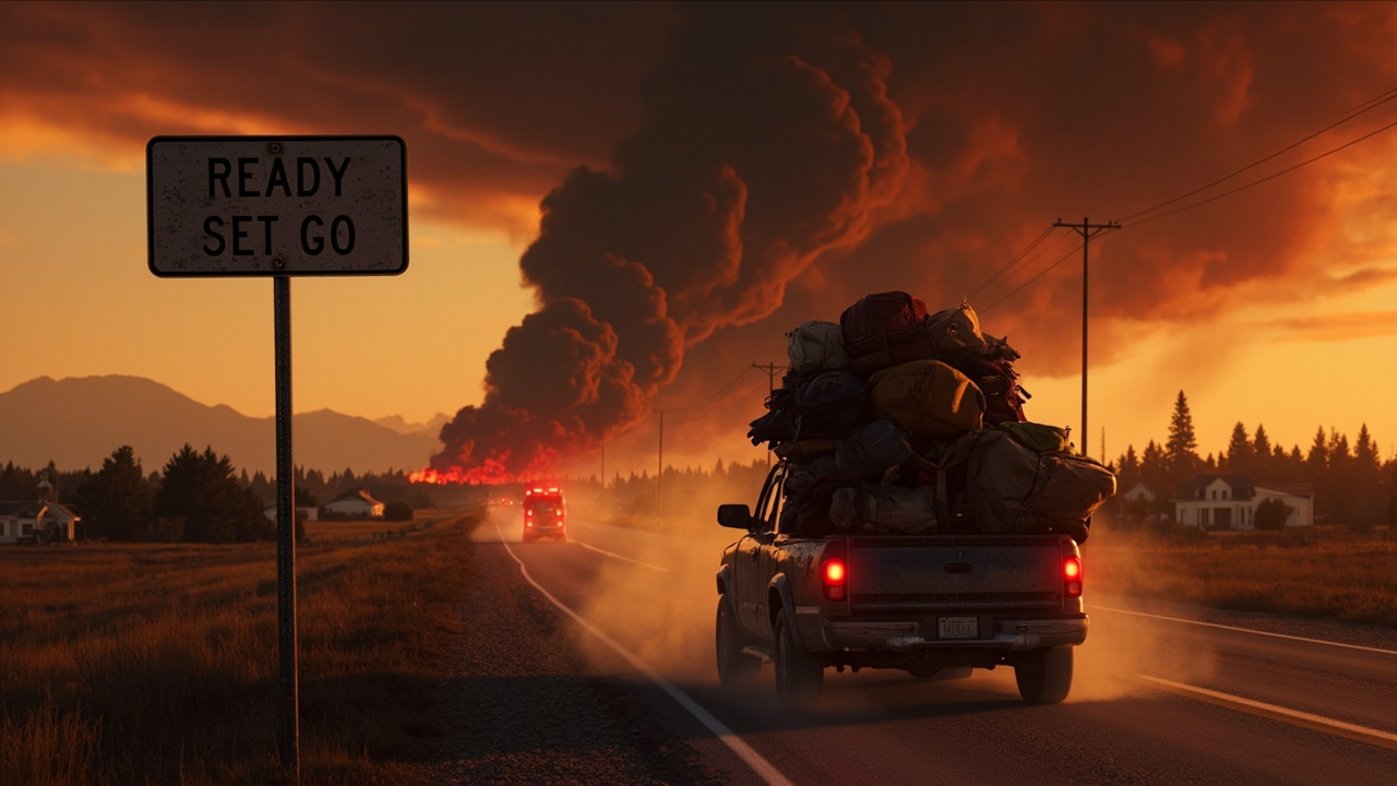
TL;DR: READY means get prepared, SET means be ready to leave immediately, and GO means evacuate now via the designated primary route.
Evacuation Order Guide: What READY, SET and GO Require From Households
READY, SET and GO divide evacuation into three action stages, and the June 2026 fires in Nebraska and northwest Colorado show how officials apply them street by street. According to KNOP News 2, the South Fork Fire near Crawford, Nebraska, reached 42% containment at 32,818 acres when evacuation orders were adjusted for multiple zones. According to News Usa Today, residents living north of Hayden, Colorado, were placed under a pre-evacuation notice on Friday afternoon as crews mobilized to contain a wildfire burning in that region.
The core distinction is status and required response. According to News Usa Today, READY carries voluntary status, SET carries pre-evacuation status, and GO carries mandatory status. The same report lists the required response for READY as preparing go-bags, monitoring local news and planning evacuation routes. The required response for SET is packing vehicles, moving livestock and being prepared to leave immediately. The required response for GO is evacuating the area via the designated primary route.
Households do best when they match the label to the next physical task. READY means work lists and routes. SET means the vehicle is loaded and animals are moved. GO means travel has started. The Nebraska and Colorado incidents illustrate why waiting to decode wording wastes time, because wind, smoke and road impacts can change access quickly.
What READY Means in Practice
Prepare bags, information and routes
READY is the voluntary stage before movement is requested. According to News Usa Today, the tasks tied to READY are preparing go-bags, monitoring local news and planning evacuation routes. Those three actions form the household baseline.
Go-bags come first because later stages assume packing is already finished. Monitoring local news keeps the address-level picture current. Planning evacuation routes identifies the primary path and backups before smoke or congestion limits choices.
In the Nebraska event, READY covered a wide geography. According to KNOP News 2, READY included residents within the City of Crawford. READY also included areas north and west of the fire from Toadstool Road west to Orella Road, to Hat Creek Road, to Pants Butte Road, south to Highway 20, and north of Highland and Cottonwood Roads.
The breadth of that READY footprint shows that READY is not limited to homes adjacent to flames. It can include a city and surrounding road corridors where smoke, traffic and spot growth could affect movement. Households in READY should treat document gathering as part of bag preparation. According to News Usa Today, pre-evacuation notices under Ready, Set, Go protocols are designed to give families lead time necessary to secure livestock, gather essential documents and identify primary escape routes before roads become gridlocked or compromised by smoke.
Why READY arrives early in grass and timber country
Early READY notices reflect how fast fire can move in mixed terrain. According to News Usa Today, Hayden sits within Routt County, an area defined by a mix of agricultural land, expansive rangelands and dense timber of the Yampa Valley. When fire breaks out in this terrain, the report identifies the primary threat as the speed at which erratic wind patterns can drive a blaze across dry grasslands.
That speed explains the emphasis on escape routes during READY. According to News Usa Today, identifying primary escape routes before roads become gridlocked or compromised by smoke is one of the purposes of the lead time. Families that select routes during READY avoid route decisions during smoke and sirens.
Seasonal drying adds context for June. As noted by the National Interagency Fire Center in the News Usa Today report, the transition from late spring to early summer is a critical window in the Rockies. As snowpacks melt and vegetation dries out, the report states, the landscape enters a state of high flammability that persists until the arrival of monsoon moisture.
What SET Means in Practice
Pack the vehicle and move livestock
SET is the pre-evacuation stage. According to News Usa Today, SET means packing vehicles, moving livestock and being prepared to leave immediately. The shift from READY is physical: bags move from the house to the vehicle, and animals move to transport or safer holding.
According to News Usa Today, initial reports confirmed by CBS News described the Hayden-area alert as signaling that while an immediate threat to life and property had not yet necessitated a mandatory flight, the volatile nature of fire behavior in the high-desert landscape requires residents to be prepared to leave at a moment's notice. That description captures SET. No mandatory flight has been issued, yet departure could be required with little additional warning.
In Nebraska, SET covered named corridors and a recreation site. According to KNOP News 2, SET included residents south of Highway 20 to 4 Mile Road in Sioux County and Fort Robinson in Dawes County. SET also included the area south of Highland Road, west from Cottonwood Road to Highway 20, then back east to Cottonwood Road.
Households in SET should keep phones charged and alerts enabled because the next change can be GO. According to News Usa Today, the transition is typically communicated through the Routt County Office of Emergency Management in the Colorado case, which utilizes integrated public alert systems to ping cell phones and activate localized sirens. While that procedure refers to Routt County, it shows the channels to watch: phone pings and localized sirens alongside news updates.
Who issues the change from SET to GO
Authority matters when fatigue sets in. According to News Usa Today, if fire conditions deteriorate, Routt County officials will shift from a pre-evacuation notice to a mandatory order. The decision rests with county officials and emergency management, not with social speculation.
Residents are reminded in that report that mandatory orders are not suggestions. They are described as legal directives issued to ensure that first responders can focus on suppression rather than search-and-rescue operations. That distinction helps households override hesitation. Staying does not only affect the household; it redirects responders from suppression to rescue.
What GO Means in Practice
Leave now on the designated route
GO is the mandatory stage. According to News Usa Today, the required response is to evacuate the area via the designated primary route. The emphasis on the designated primary route reduces improvised driving through smoke or closed roads.
In Nebraska, GO was drawn tightly around specific roads. According to KNOP News 2, GO covered areas west of Dodd Road and south of Cottonwood Road to Highway 20. That precision shows why address checks matter. A household one road outside GO may be SET or READY, with different tasks, while a household inside GO must travel.
Travel planning should include fire-impacted roads. According to KNOP News 2, the Nebraska Department of Transportation was advising those traveling in the area to refer to the Nebraska 511 app to help them navigate around fire-impacted roads. Checking that app before departure can prevent turning toward a closure.
How many responders are behind the lines
GO zones are active work areas. According to KNOP News 2, about 562 personnel were actively working on the South Fork Fire as of Saturday. That staffing level explains why officials restrict re-entry and movement inside GO. Crews need road space for engines, patrols and night operations.
According to KNOP News 2, the greatest area of containment was on the southern edge of the fire near Crawford and up to the north to the division break to the northeast. Firefighters were patrolling and securing the containment line, as well as mopping up any lingering areas of heat. Fort Robinson also had containment line around its entire perimeter. Fire crews continued to maintain a presence in Crawford with both day and night shifts.
Households should not interpret visible patrols as permission to return early. Patrol, securing and mop-up are suppression tasks inside and near controlled edge, not an all-clear for residents. Return decisions arrive through evacuation updates, including lifted zones.
Lifted Zones and Return Movement
Two Nebraska areas moved out of evacuation status
Evacuation status can be lowered when conditions allow. According to KNOP News 2, evacuation orders were lifted for residents northwest of Crawford and south of Forest Service Road 928, west of Highway 2/71 to Toadstool Road. Orders were also lifted for the area south of Highway 20, west and north of White River Road, and east of Andrews Road.
Lifting is location-specific. A lifted area near Crawford does not change GO west of Dodd Road or SET south of Highway 20. Households should verify their own address against the current map rather than assuming a nearby lifting applies to them.
Night work continues even where lines hold. According to KNOP News 2, night operations remained in place across the fire, with some resources located in Crawford, while the majority were on the western active area of the fire. That distribution shows continued risk on the western side despite overall containment progress.
Direct tactics and aircraft support behind the map
Tactics help explain why one edge holds while another stays active. According to KNOP News 2, on Saturday on the west side of the fire, cooler, cloudy weather conditions and higher relative humidity allowed fire managers to use a direct strategy to suppress fire growth above Cottonwood Road that took place Friday night. Cooler and more humid hours created an opening for direct work on that growth.
Technology supported decisions on both edges. According to KNOP News 2, unmanned aircraft systems were being used on the South Fork Fire. UAS provide fire managers real-time situational awareness, can detect hotspots, and allow for safer operations in high-risk environments, where the terrain or fuels are especially dangerous.
Mission detail shows how that support was applied. According to KNOP News 2, on Saturday UAS missions flew to scout the fire ground and gather information for planning on the western part of the fire. Along the southern edge, the UAS infrared capabilities were used for mapping needs. Scout flights informed western planning, while infrared mapping supported the southern edge where containment was strongest.
Weather Windows That Change Alert Levels
From cooler humidity to fire weather watch
Weather can move zones in either direction. According to KNOP News 2, NEMA said the expected cloud cover passed through the area overnight. Sunday would be considerably less windy, first coming from the northwest and then from the west, and would be slope and terrain driven.
The forecast after Sunday pointed toward higher danger. According to KNOP News 2, starting Monday, expected warmer drier conditions prompted a fire weather watch that day and fire danger climbs rapidly from Monday through Wednesday. Households in READY and SET should use calmer hours for packing, livestock moves and route checks, because warmer and drier days can accelerate need for GO.
The Colorado report adds a seasonal frame. According to News Usa Today, researcher Dr. Elena Vasquez at the Western Fire Research Center is quoted on unpredictability, with the report carrying her assessment that wildfire behavior is no longer predictable based on historical averages alone. The report also carries her observation about earlier starts and later ends creating vigilance for rural communities previously considered lower-risk. Those assessments explain why June notices in Routt County and the Nebraska Panhandle arrived with strong preparation language.
Smoke, Health and Travel During Evacuation Status
Indoor air steps while fire burns nearby
Smoke planning belongs in READY, not after coughing starts. According to KNOP News 2, officials were referring those with respiratory concerns to state references on air quality and particle pollution, advising them to stay updated on air quality in their area.
Indoor steps were specific. According to KNOP News 2, the Panhandle Public Health District recommends preventing further indoor air pollution by avoiding or limiting the use of air fresheners, candles and diffusing oils. The district also recommends avoiding broiling or frying foods and using gas appliances, and avoiding smoking or vaping indoors.
Those steps reduce added particles inside while outdoor smoke is present. Households with respiratory concerns should pair air-quality updates with evacuation readiness, because smoke-impacted READY zones can become SET or GO if fire and wind shift.
Navigation and information discipline
Road status changes during active fire. According to KNOP News 2, travelers were pointed to the Nebraska 511 app for fire-impacted roads. Households should check that source before leaving and recheck if rerouted, because closures can expand with western fire activity.
Information discipline also matters. According to News Usa Today, the Ready, Set, Go lead time is intended to let families secure livestock, gather documents and identify escape routes before gridlock or smoke complicates roads. Acting during READY and SET preserves that advantage. Waiting until GO to begin packing or animal moves surrenders it.
Sources referenced
- Nebraska Panhandle wildfire remains at 42% containment; Evacuation orders adjusted for several areas - KNOP News 2 (https://www.knopnews2.com/2026/06/13/nebraska-panhandle-wildfire-remains-42-confinement-evacuation-orders-adjusted-several-areas/)
- Pre-evacuation Notice Issued for Northwest Colorado Wildfire - News Usa Today (https://news-usa.today/pre-evacuation-notice-issued-for-northwest-colorado-wildfire/)